Property Record
3843 Buford Dr, Buford, GA 30519
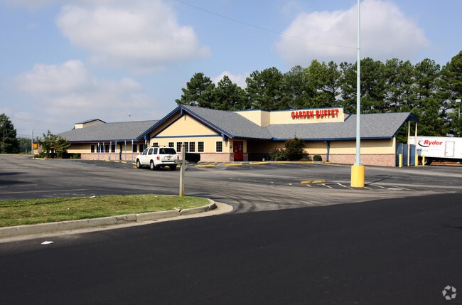

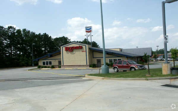

Property Detail
3843 Buford Dr
7-219-087
HWY 20
Restaurantbuilding
Gwinnett
C2
Georgia
B and X Area of moderate flood hazard, usually the area between the limits of the 100-year and 500-year floods.
1.73 AC
2025
Suwanee/Buford
2025
Atlanta
050115
Atlanta-Sandy Springs-Roswell, GA
10,740 SF
NEARBY LISTINGS FOR SALE OR LEASE
DEMOGRAPHICS near 3843 Buford Dr
1 mile
3 mile
5 mile
2024 Total Population
4,229
58,735
148,641
2029 Population
4,441
62,429
157,051
Pop Growth 2024-2029
+ 5.01%
+ 6.29%
+ 5.66%
Average Age
37
37
38
2024 Total Households
1,427
19,670
49,011
HH Growth 2024-2029
+ 5.12%
+ 6.48%
+ 5.86%
Median Household Inc
$62,411
$86,067
$94,702
Avg Household Size
2.90
2.90
3.00
2024 Avg HH Vehicles
2.00
2.00
2.00
Median Home Value
$458,857
$455,376
$436,068
Median Year Built
2002
2004
2001
Nearby Places
Map Layers
Map Styles
 Street
 Aerial
Transit
 Traffic
 Biking
Places
Listings with unknown addresses are not visible on the map
- Restaurants
- Banks
- Shops
- Fitness
- Groceries
PUBLIC TRANSPORTATION
AIRPORT
Hartsfield - Jackson Atlanta International
Drive
Walk
Distance
Hartsfield - Jackson Atlanta International
57 min
44.6 mi
Nearby Properties
Address
Land Use
TOTAL SIZE
Lot Size
Zoning
Address
Land Use
TOTAL SIZE
Lot Size
Zoning
1,435,842 SF
83.47 AC
C2
Address
Land Use
TOTAL SIZE
Lot Size
Zoning
629,478 SF
1.54 AC
BG
Address
Land Use
TOTAL SIZE
Lot Size
Zoning
563,718 SF
41.75 AC
RM13
Address
Land Use
TOTAL SIZE
Lot Size
Zoning
419,467 SF
665.75 AC
RZT
Address
Land Use
TOTAL SIZE
Lot Size
Zoning
455,605 SF
33.93 AC
RM13
Address
Land Use
TOTAL SIZE
Lot Size
Zoning
461,593 SF
14.11 AC
MUR
Address
Land Use
TOTAL SIZE
Lot Size
Zoning
1,113,809 SF
57.50 AC
M1
Address
Land Use
TOTAL SIZE
Lot Size
Zoning
488,895 SF
7.50 AC
OI
Address
Land Use
TOTAL SIZE
Lot Size
Zoning
330,562 SF
29.62 AC
RM13
Address
Land Use
TOTAL SIZE
Lot Size
Zoning
394,831 SF
16.37 AC
RM24
Address
Land Use
TOTAL SIZE
Lot Size
Zoning
684,003 SF
60.84 AC
M1
Address
Land Use
TOTAL SIZE
Lot Size
Zoning
286,520 SF
21.60 AC
P
Address
Land Use
TOTAL SIZE
Lot Size
Zoning
368,594 SF
2 AC
Address
Land Use
TOTAL SIZE
Lot Size
Zoning
379,178 SF
39.27 AC
RM10
Address
Land Use
TOTAL SIZE
Lot Size
Zoning
384,000 SF
23.08 AC
BG
Address
Land Use
TOTAL SIZE
Lot Size
Zoning
619,498 SF
51.81 AC
M1
Address
Land Use
TOTAL SIZE
Lot Size
Zoning
335,641 SF
28.90 AC
RM10
Address
Land Use
TOTAL SIZE
Lot Size
Zoning
431,273 SF
11.68 AC
BG
Address
Land Use
TOTAL SIZE
Lot Size
Zoning
521,231 SF
46.16 AC
HM1
Address
Land Use
TOTAL SIZE
Lot Size
Zoning
282,431 SF
23.20 AC
RM13
Address
Land Use
TOTAL SIZE
Lot Size
Zoning
282,630 SF
11.83 AC
MUO
Address
Land Use
TOTAL SIZE
Lot Size
Zoning
313,869 SF
12.19 AC
RM24
Address
Land Use
TOTAL SIZE
Lot Size
Zoning
335,438 SF
10.94 AC
MUR
Address
Land Use
TOTAL SIZE
Lot Size
Zoning
461,700 SF
43.77 AC
C2
Address
Land Use
TOTAL SIZE
Lot Size
Zoning
367,756 SF
12.04 AC
RM
Address
Land Use
TOTAL SIZE
Lot Size
Zoning
121,100 SF
3.74 AC
RM24
Address
Land Use
TOTAL SIZE
Lot Size
Zoning
192,805 SF
12.40 AC
RM24
Address
Land Use
TOTAL SIZE
Lot Size
Zoning
323,877 SF
29.14 AC
C2
Address
Land Use
TOTAL SIZE
Lot Size
Zoning
102,152 SF
20.95 AC
C2
Address
Land Use
TOTAL SIZE
Lot Size
Zoning
144,000 SF
21.13 AC
RM
The World's #1 Commercial Real Estate Marketplace
Connect with us
© 2026 CoStar Group
The information above has been obtained from sources believed reliable. While we do not doubt its accuracy we have not verified it and make no guarantee, warranty or representation about it. It is your responsibility to independently confirm its accuracy and completeness. Any projections, opinions, assumptions, or estimates used are for example only and do not represent the current or future performance of the property. The value of this transaction to you depends on tax and other factors which should be evaluated by your tax, financial, and legal advisors. You and your advisors should conduct a careful, independent investigation of the property to determine to your satisfaction the suitability of the property for your needs.